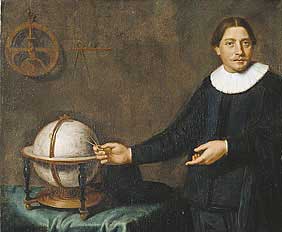
Fragment of "Portrait of Abel Tasman, his wife and daughter" attributed to Jacob Gerritsz Cuyp, 1637 (not fully authenticated)[1]
Born day unknown 1603
Lutjegast, DutchRepublic
Died 10 October 1659(1659-10-10) (aged 56)
Batavia (Jakarta),
Dutch East Indies
Nationality Dutch
Occupation navigator and explorer
Spouse Claesgie Meyndrix
Joanna Tiercx
Abel Janszoon Tasman (Dutch pronunciation: [ˈaːbəl ˈjɑnsoʊn ˈtɑsmɐn]; 1603 – 10 October 1659) was a Dutch seafarer, explorer, and merchant, best known for his voyages of 1642 and 1644 in the service of the VOC (United East India Company). His was the first known European expedition to reach the islands of Van Diemen's Land (now Tasmania) and New Zealand and to sight the Fiji islands. His navigator François Visscher, and his merchant Isaack Gilsemans mapped substantial portions of Australia, New Zealand and some PacificIslands.
[edit] First pacific voyageAbel Tasman was born in 1603 in Lutjegast, a village in the province of Groningen. He was first heard of at the end of 1631, as a widower living at Amsterdam, where he married Jannetje Tjaers at that time. In 1633 Tasman joined the Dutch East India Company and sailed to Batavia; four years later he was back in Amsterdam. Tasman signed for another ten years and took his wife along to Batavia. In 1639 Tasman was sent as second in command of an exploring expedition in the north Pacific under Matthijs Quast. His fleet included the ships Engel and Gracht and reached FortZeelandia (Dutch Formosa) and Deshima. In 1642 he signed a friendly trading treaty with the Sultan of Palembang, Sumatra [2] offering military protection for pepper.
The route of the first and second voyage
The Abel Tasman map 1644, also known as the Bonaparte Tasman map. This map is part of the collection of the State Library of New South Wales, Australia.
Mauritius
Coastal cliffs of TasmanPeninsula
Murderers' Bay, drawing by Isaack Gilsemans [3]
Maori
Abel TasmanNational Park
Tongatapu, drawing by Isaack Gilsemans
The bay of Tongatapu with the two ships, drawing by Isaack Gilsemans
Canoe near Solomons islands
A dugout canoe of pirogue type in the PacificIn August 1642, the Council of the Indies, consisting of Antonie van Diemen, Cornelis van der Lijn, Joan Maetsuycker, Justus Schouten, Salomon Sweers, Cornelis Witsen, and Pieter Boreel in Batavia despatched Abel Tasman and Franchoijs Visscher on a voyage of which one of the objects was to obtain knowledge of "all the totally unknown provinces of Beach".[4]
[edit] Beach, and Terra AustralisBeach appeared on maps of the time, notably that of Abraham Ortelius of 1570 and that of Jan Huygen van Linschoten of 1596, as the northernmost part of the southern continent, the Terra Australis, along with Locach. According to Marco Polo, Locach was a kingdom where gold was “so plentiful that no none who did not see it could believe it”. Beach was in fact a mistranscription of Locach. Locach was Marco Polo’s name for the southern Thai kingdom of Lavo, or Lop Buri, the “city of Lavo”, (ลพบร, after Lavo, the son of Rama in Hindu mythology).[5] In Chinese (Cantonese), Lavo was pronounced “Lo-huk” (羅斛), from which Marco Polo took his rendition of the name.[6] In the German cursive script, “Locach” and “Beach” look similar[citation needed], and in the 1532 edition of Marco Polo’s Travels his Locach was changed to Boëach, later shortened to Beach.[7] They seem to have drawn on the map of the world published in Florence in 1489 by Henricus Martellus, in which provincia boëach appears as the southern neighbour of provincia ciamba. Book III of Marco Polo’s Il Milione described his journey by sea from China to India by way of Champa (= Southern Vietnam), Java (which he called Java Major), Locach and Sumatra (called Java Minor). After a chapter describing the kingdom of Champa there follows a chapter describing Java (which he did not visit himself).[8] The narrative then resumes, describing the route southward from Champa toward Sumatra, but by a slip of the pen the name “Java” was substituted for “Champa” as the point of departure, locating Sumatra 1,300 miles to the south of Java instead of Champa. Locach, located between Champa and Sumatra, was likewise mis-placed far to the south of Java, by some geographers on or near an extension of the Terra Australis.[9] As explained by Sir Henry Yule, the editor of an English edition of Marco Polo’s Travels: “Some geographers of the 16th century, following the old editions which carried the travellers south-east of Java to the land of “Boeach” (or Locac), introduced in their maps a continent in that situation”.[10] Gerard Mercator did just that on his 1541 globe, placing Beach provincia aurifera (“Beach the gold-bearing province”) in the northernmost part of the Terra Australis in accordance with the faulty text of Marco Polo’s Travels. It remained in this location on his world map of 1569, with the amplified description, quoting Marco Polo, Beach provincia aurifera quam pauci ex alienis regionibus adeunt propter gentis inhumanitatem (“Beach the gold-bearing province, wither few go from other countries because of the inhumanity of its people”) with Lucach regnum shown somewhat to its south west.[11] Following Mercator, Abraham Ortelius also showed BEACH and LVCACH in these locations on his world map of 1571. Likewise, Linschoten’s very popular 1596 map of the East Indies showed BEACH projecting from the map’s southern edge, leading (or mis-leading) Visscher and Tasman in their voyage of 1642 to seek Beach with its plentiful gold in a location to the south of the Solomon Islands somewhere between Staten Land near Cape Horn and the Cape of Good Hope.[12] Confirmation that land existed where the maps showed Beach to be had come from Dirk Hartog’s landing in October 1616 on its west coast, which he called Eendrachtsland after the name of his ship.
[edit] MauritiusIn accordance with Visscher's directions, Tasman sailed first to Mauritius and arrived on 5 September 1642. The reason for this was the crew could be fed well on the island; there was plenty of fresh water and timber to repair the ships. Tasman got the assistance of the governor Adriaan van der Stel. Because of the prevailing winds Mauritius was chosen as a turning point. After a four week stay on the island both ships left on 8 October. After one month it started to snow and hail; Tasman changed course more north. Part of the western shore of the continent was already known to the Dutch, but but no one had gone as far as Pieter Nuyts.
[edit] TasmaniaOn the 24th November 1642 Abel Tasman sighted the west coast of Tasmania, north of Macquarie Harbour.[13] He named his discovery Van Diemen's Land after Anthony van Diemen, Governor-General of the Dutch East Indies. Proceeding south he skirted the southern end of Tasmania and turned north-east, Tasman then tried to work his two ships into Adventure Bay on the east coast of South Bruny Island where he was blown out to sea by a storm, this area he named Storm Bay. Two days later Tasman anchored to the North of Cape Frederick Hendrick just North of the ForestierPeninsula. Tasman then landed in BlackmanBay – in the larger MarionBay. The next day, an attempt was made to land in North Bay; however, because the sea was too rough the carpenter swam through the surf and planted the Dutch flag in North Bay. Tasman then claimed formal possession of the land on 3 December 1642.
[edit] New ZealandAfter some exploration, Tasman had intended to proceed in a northerly direction but as the wind was unfavourable he steered east. On 13 December they sighted land on the north-west coast of the South Island, New Zealand, becoming the first Europeans to do so.[14] Tasman named it Staten Landt on the assumption that it was connected to an island (Staten Island, Argentina) at the south of the tip of South America. Proceeding north and then east, he stopped to gather water, but one of his boats was attacked by Māori in waka (canoes) and four of his men and several Māori[15] were killed. Archeological research has shown the Dutch had tried to land at a major agricultural area, which the Māori may have been trying to protect.[16] Tasman named the bay Murderers' Bay (now known as Golden Bay) and sailed north, but mistook Cook Strait for a bight (naming it Zeehaen's Bight). Two names he gave to New Zealand landmarks still endure, Cape Maria van Diemen and ThreeKingsIslands, but Cabo Pieter Boreels is now known as CapeEgmont.
[edit] The return voyageOn route back to Batavia, Tasman came across the Tongan archipelago on 20 January 1643. While passing the Fiji Islands Tasman's ships came close to being wrecked on the dangerous reefs of the north-eastern part of the Fiji group. He charted the eastern tip of Vanua Levu and Cikobia before making his way back into the open sea. He eventually turned north-west to New Guinea, and arrived at Batavia on 15 June 1643.
[edit] Second Pacific voyageWith three ships on his second voyage (Limmen, Zeemeeuw and the tender Braek) in 1644, he followed the south coast of New Guinea eastwards. He missed the Torres Strait between New Guinea and Australia, and continued his voyage along the Australian coast. He mapped the north coast of Australia making observations on the land, called New Holland, and its people.
From the point of view of the Dutch East India Company Tasman's explorations were a disappointment: he had neither found a promising area for trade nor a useful new shipping route. For over a century, until the era of James Cook, Tasmania and New Zealand were not visited by Europeans – mainland Australia was visited, but usually only by accident.
[edit] Later lifeOn 2 November 1644 Abel Tasman was appointed a member of the Council of Justice at Batavia. He went to Sumatra in 1646, and in August 1647 to Siam (now Thailand) with letters from the company to the King. In May 1648 he was in charge of an expedition sent to Manila to try to intercept and loot the Spanish silver ships coming from America, but he had no success and returned to Batavia in January 1649. In November 1649 he was charged and found guilty of having in the previous year hanged one of his men without trial, was suspended from his office of commander, fined, and made to pay compensation to the relatives of the sailor. On 5 January 1651 he was formally reinstated in his rank and spent his remaining years at Batavia. He was in good circumstances, being one of the larger landowners in the town. He died at Batavia in October 1659 and was survived by his second wife and a daughter by his first wife. The poor in Lutjegast received the small amount of only 25 guilders.[17]